Geomaat accelerates the future of mobility with smart data and AI
Within the DITM innovation programme, Geomaat, a surveying engineering company, is working with TomTom and others on the digital infrastructure for future-proof mobility. Through smart automation, AI and cloud computing, the company is taking an important step: from measurement to map in a single weekend. An approach that ensures up-to-date, accurate maps and immediate social impact.
What is DITM?
DITM stands for Digital Infrastructure for Future-Proof Mobility. It is a four-year, nationwide innovation programme in which governments, knowledge institutions and companies collaborate on smart mobility solutions. In work package 4, Geomaat, TomTom, Siemens, TNO, Monotch and V-tron are joining forces to enrich digital maps with real-time vehicle data and AI-supported processing. The goal: to provide up-to-date and reliable map information as the foundation for automated transport.
From raw data to ready-to-use map in a weekend
Geomaat works within DITM with a clear vision: collect data on Friday, process it automatically over the weekend, and start with a usable map on Monday. This approach is possible thanks to a fully automated processing cycle: once the measurement data has been collected on Friday, smart systems take over. Over the weekend, algorithms and cloud computers perform all the necessary analyses without manual intervention.
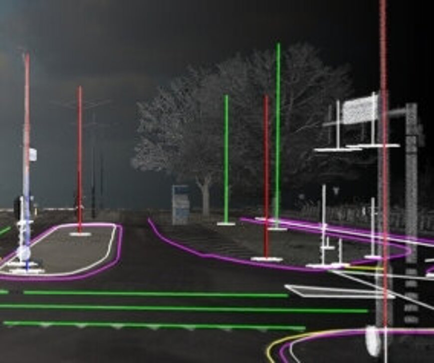
In recent years, Geomaat has developed various innovations to make this process possible, such as automatic arrow detection, point cloud classification, and recognition of traffic signs and markings. These point clouds, generated with lidar laser scanners, form a 3D visualisation of the environment. Thanks to smart algorithms, objects are automatically recognised and correctly placed on maps.
AI in practice: from traffic signs to maintenance planning
A concrete example: in collaboration with various municipalities, Geomaat uses automatically recognised traffic signs and markings to draw up maintenance plans. This saves time, reduces errors and increases safety.
AI plays a dual role here. On the one hand, it helps to recognise objects in point clouds or panoramic images. On the other hand, a second AI model determines how those objects are correctly incorporated into the map, adapted to the client's requirements.
This translation makes the work complex: every organisation has different requirements for map data. That is why Geomaat develops flexible AI models that combine intelligently with human validation. This shifts the work from manual drawing to quality control.

Taskrunner speeds up the process
A major accelerator in this process is Geomaat's own cloud computing platform: Taskrunner. This tool distributes heavy computing tasks across dozens of computers. What used to take twenty hours on a single machine now takes one hour on twenty systems.
In practice, this means starting data analysis in the evening and continuing with the results in the morning. Taskrunner is now a standard part of projects, from road inspections to reconstructions.
Collaboration with TomTom: precision and timeliness combined
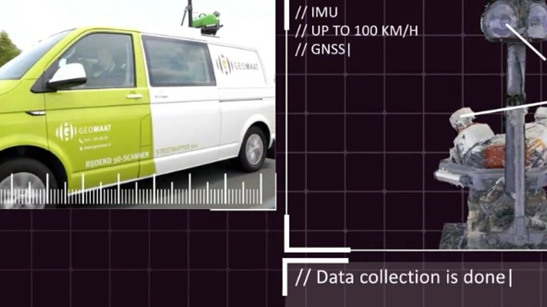
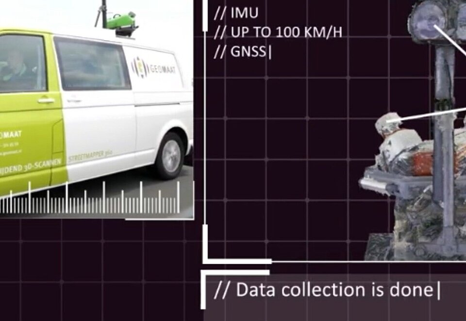
An important part of work package 4 is the collaboration with TomTom. Geomaat provides centimetre-precise data via mobile laser scanners. TomTom has access to up-to-date vehicle data from sensors in cars on the road (Sensor Derived Observations).
Combining these two datasets creates a digital map that is both up-to-date and accurate. Geomaat provides the precision, TomTom the timeliness. In this way, they reinforce each other and build an infrastructure that is ready for the future.
Social value: technology that works for everyone
Creating faster, more reliable and smarter maps has direct social value. Local authorities can make faster decisions about maintenance, reconstruction or road safety.
And accurate map data is crucial for automated vehicles. Approximate data is not good enough for smart mobility, Geomaat provides data that is exactly right. By investing in automation and AI now, Geomaat is working on the infrastructure that will soon be needed for safe and smart traffic.